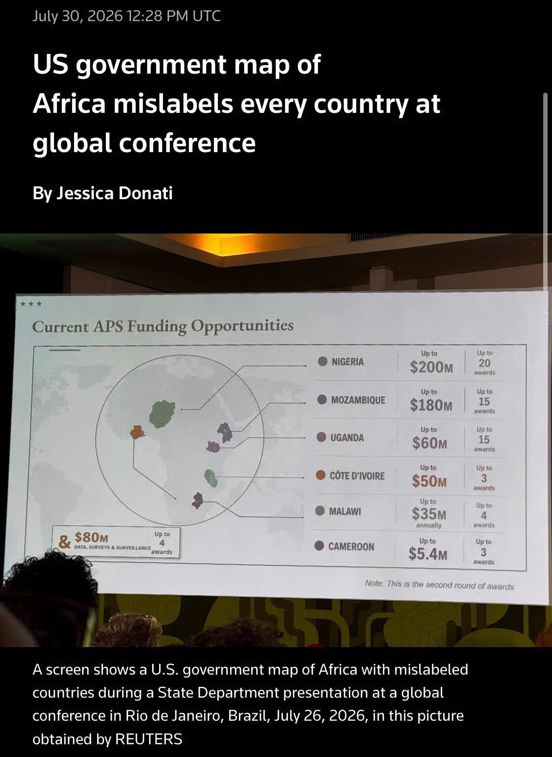
#USA gov't map of #Africa mislabels every country at global conference ‼️

The map contained an #AI watermark indicating it was made w/ OpenAI tools. 👀

It had:
• Nigeria (where #US currently has several hundred troops deployed) as landlocked in the Sahara Desert
• Mozambique, which is in southeastern Africa, relocated to the Horn of Africa
• Ivory ​Coast in West Africa was placed on the other side of the continent

The State Dept blamed a staffer.

#trump #TrumpAdmin
--
reuters.com/world/africa/us-go

July 30, 2026 12:28 PM UTC
US government map of
Africa mislabels every country at global conference
By Jessica Donati
Current APS Funding Opportunities
$80м
Up to
DATA, SURVEYS & SURVEILLANCE awards
• NIGERIA
Up to
$200M
Up to 20
awards
• MOZAMBIQUE
Up to
$180M
Up to 15
awards
• UGANDA
Up to
$60м
Up to 15
awards
CÔTE D'IVOIRE
Up to
$50м
Up to 3
awards
| MALAWI
Up to
$35M
annually
Up to 4
awards
• CAMEROON
Up to
$5.4м
Up to 3
awards
Note: This is the second round of awards
A screen shows a U.S. government map of Africa with mislabeled countries during a State Department presentation at a global conference in Rio de Janeiro, Brazil, July 26, 2026, in this picture obtained by REUTERS
ALT
Edited ⁨⁨Jul⁩ ⁨30⁩, ⁨2026⁩, ⁨17:38⁩⁩en